We are talking about Maps in Kindergarten this week. We are learning all about where we are on the map.
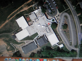
Monday we talked about our house. We looked on Google Earth to see what our houses look like. We looked at them from the Front View and from the Bird’s Eye View.
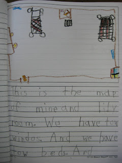
During journals, we drew and wrote about the Bird’s Eye View of our bedroom. We think it is strange looking at our bedroom from up above. All of the things in our bedroom look like shapes from a Bird’s Eye View.
On Tuesday, we talked about our city. We live in the city of Mooresville. There are a lot of things in our city. We have churches, banks, a hospital, schools, fire houses, a police station, gas stations, houses and many other things in Mooresville.
We looked at our school on Google Earth. It was cool to see what the Kindergarten building looks like from up above. We drew a map of our classroom and put an X where we sit. Then, we drew how we walk from the door to our seat and from our seat to the bathroom.
In journals, we drew a road map and a key for it.
Today, we talked about our state. We live in North Carolina. Here are some interesting facts we learned about North Carolina:
“We have beaches and mountains in North Carolina.” Gracie
“Our state drink is milk.” Nick
“Our state bird is the cardinal.” Levi
“The biggest city in North Carolina is Charlotte.” Wesley
“Our state sport is Nascar.” Joshua
“Our state insect is the honey bee.” Josh
“Our capital is Raleigh.” Jatzibe
We are having a great week learning all about maps. We will talk about our country, our continent and our planet tomorrow and Friday. We can’t wait!


No comments:
Post a Comment